Go to Cart 0,00 €
0
Barbados
General Information
Things to do
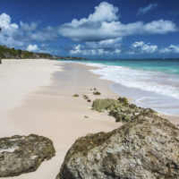
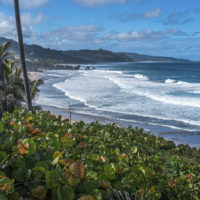
There is a big variety of activities available on Barbados. The island has more than 50 beaches and they are all public. Besides a few stretches on the West coast most beaches are easily accessible. On the East (Atlantic) coast swimming is not recommended in most locations and rather dangerous due to strong currents. However, there are great surf spots. The “Soup Bowl” in the village of Bathsheba is host to an annual competition in November. One of the most beautiful beaches for many locals which is also good for swimming is Miami beach in the South of the island. There are also great spots for windsurfing mostly in the South.
Cricket is the #1 sport of the island due to its colonial heritage. The annual Barbados Gold Cup in Sandy Lane attracts many spectators as one of the Caribbean’s best known horse race. The center for nightlife is on the West coast. A variety of bars, clubs, and restaurants can be found at the St. Lawrence Gap or “The Gap”. If you like to mingle with locals Baxter’s Road is a good recommendation for a night out.
Transportation to and on the island
A number of international airlines offer service to Barbados from the US and Canada as well as from many European countries.
Direct flights from several major North American airports such as Miami and Toronto are available with e.g. Caribbean Airlines, American Airlines, JetBlue. British Airways has direct flights from London Gatwick almost daily while Condor has a service from Frankfurt twice a week. Many Caribbean islands can easily be reached with Caribbean Airlines or LIAT. If you arrive in Barbados on a Cruise Ship or start your cruise in Barbados you will be at the harbor just outside of the Capital Bridgetown.
Public transportation on Barbados is fairly well established and available to and from popular visitor destinations. Look out for the read and white bus stop signs indicating if the route takes you “to city” or from city – always referring to Bridgetown as “city”. The standard fee is BD 2 (no foreign currency accepted) and can be paid on the bus. For travel to remote places or during later hours a rental car is recommended especially if you plan to explore areas outside of Bridgetown. Most big international rental car companies have offices at the international airport.
Climate
Warm and sunny best described Bajan weather for the most part. With more and 3,000 sunny hours per year and temperatures usually not over 30°C (86°F) Northeast winds also help keep the heat at a bearable level. While the dry season lasts from January to June rain fall usually comes in showers.
People and Culture
It is not an advertisement feature that Barbadian people are exceptionally friendly and warm. With their energy, their smile and love of life it is impossible to escape the charm of the island and its people. Whether it is the beach vendor or a fellow passenger on the bus – you will always find someone in the mood for a chat willing to share their point of view. Two unique parts of Bajan culture are the Tuk Band and the Landship. While the Tuk Band is a collection of musicians playing drums and a whistle and creating an extremely infectious rhythm the Landship is a dancing group performing popular dances in traditional attire. Both can be seen at local festivals.
History
Barbados was first discovered in the late 15th century. Although the Spanish and the Portuguese visited the island first it was claimed by the British. First European settlers from England came to the island in 1627. Barbados remained a British colony until it gained its independence in 1966. This makes it the only Caribbean island that did not change colonial powers over the centuries. Barbados is now part of the Commonwealth of Nations. The background of the island’s name “Barbados” is not completely clear. Although it is agreed that it refers to “The Bearded” this may have its origin in the roots of the fig tree that is very common on the island and which looks like a beard. It may also have its origin in the beards of the Caribs being former inhabitants of Barbados though.
Geography & Geology
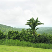
Barbados is the easternmost island of the lesser Antilles neighboring Saint Vincent and the Grenadines (about 100 miles / 170 km West) and Trinidad and Tobago (about 250 miles / 400 km Southwest). Unlike most of the lesser Antilles Barbados is quite flat with Mount Hillaby (335 metres / 1,120 feet above sea level) being the highest peak. The reason for this lies in the geological history of the island. It lies right on top of the boundary of the South American and the Caribbean plate and mostly consists of sediments and the remains of corals. The very specific landscape with many caves and gullys of Barbados is a result of the erosion of mostly limestone rock. In recent years some of them have been converted into popular tourist attractions such as Harrison Caves and Welchman Hall Gully.
